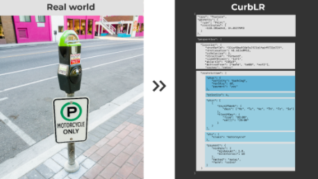
CurbLR is one of several open standard for curb data, being developed by SharedStreets.
CurbLR 1 is an open standard for digitized, geo-referenced curb information. In addition to regulatory information, CurbLR maps curb-related assets such as wheelchair cuts, bus stops, fire hydrants, signage, crosswalks, bike racks, and other physical assets. CurbLR makes use of the SharedStreets Linear Referencing System for location data.
The data exchange format for CurbLR is geoJSON. An example of a curb feature coded in CurbLR format (in this case, a motorcycle-only paid parking space) is shown below:

SharedStreets is working with the Open Mobility Foundation’s Curb Management Working Group to develop a uniform agreed standard for curb data, with CurbLR as an input to the process. Open Curbs is a similar effort that is also working with the Open Mobility Foundation.
- 1SharedStreets. (n.d.). CurbLR. Retrieved January 28, 2021, from curblr: https://curblr.org/
- Log in to post comments
